Documentation
In this stage the project is studied in detail to establish the optimal methods of measurement and processing for the best quality-price product.
We divide each project into 4 distinct stages to always deliver on time.
In this stage the project is studied in detail to establish the optimal methods of measurement and processing for the best quality-price product.
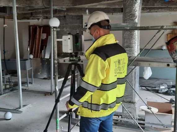
We use the fastest and most accurate equipments and measurement methods to minimize the time allocated to field measurements in such a way that the clients' activity is not interrupted or very little disturbed.
We process the measurements with specialized software using verification and control methods to always deliver a quality product.

Whether it is point clouds, 2D surveys, facade surveys, sections or 3D models, we pay great attention to the products delivered, so that they rise to the highest quality standards.
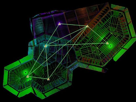
Following the processing of the measurements performed by 3D Scanning, the registration report results, which represents an indicator of precision and quality of the entire scanning, registration and georeferencing process.
It is the primary product resulting from the process of scanning, registration, georeferencing, cleaning, filtering and decimation. Delivery is usually made in the following format:
.rcp - compatible with Autodesk Recap (free software )
.e57 - compatible with most software on the market
Through the process of vectorization of the point cloud, the 2D drawings of the measured building are generated. The 2D drawings will be delivered in digital format:
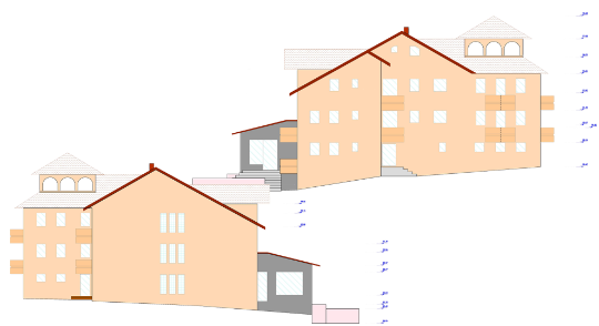
Through the process of vectorization of the point cloud, the elevations plans of the measured building are generated. The plans will be delivered in digital format:
.dwg - compatible with AutoCad and most CAD softwareThrough the process of vectorization of the point cloud, characteristic sections are generated: longitudinal section and cross section. The sections are taught in digital format:
.dwg - compatible with AutoCad and most CAD softwarereliable for