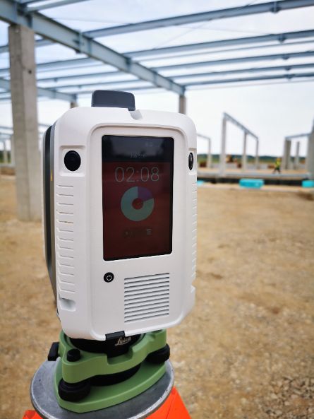
3D SCANNING & MODELLING

faster - better - smarter

Due to the scanning speed (double that of any competitor) and the innovative system that allows for pre-registration of the point cloud on site, we provide unparalleled performance in measuring and processing point clouds.

EQUIPMENT

We use Leica RTC360 scanner for the many advantages it offers: it is the fastest laser scanner in the world, it is the first equipment in the world equipped with VIS positioning system (for indoor) it is the only equipment that is able to take a 360 panorama with 5 exposures HDR in a minute. The equipment has small size and weight, this helps us to scan practically in any location. The emitted laser beams have two different amplitudes (HDR EDM) for areas with low reflectivity and for an almost noiseless cloud.

IT IS THE FASTEST SCANNER IN THE WORLD

With an acquisition rate of 2 million points / second. This allows us not to stop or disturb too much the activity of the beneficiaries

VIS SYSTEM (VISUAL INERTIAL SYSTEM)

The only scanner with an optical system consisting of 5 cameras for positioning inside buildings. This helps us to increase the efficiency of the registration process (office operations).

3 HDR CAMERAS

Cameras take a spherical image with 5 HDR exposures in one minute (the fastest scanner in the world)

HDR EDM

laser beams emitted with two different amplitudes for areas with low reflectivity and for an almost noiseless cloud

Scanare 3D

WHAT YOU CAN RECEIVE

DELIVERABLE 3D SCAN

Following the 3D scanning process, the following can be delivered:

Point Cloud

Represents the primary product resulting from 3D scanning, it can be color (coloring based on HDR photos taken by the scanner) or gray tones (representing a sampling of the response intensity of laser beams). Delivery can be made in different formats: .las, .e57, .rcp (compatible with AutoDesk environment). 

It can be used to view the scanned object, to make measurements of the various elements, to establish their position or to witness the situation at the time of the scan.

360 PHOTOGRAPHS

The photos taken by the scanner (12MP x 3 x 5 HDR exposures) are composed in the import process for generating 360 HDR panoramas in equirectangular projection. Panoramas can be composed to generate 360 virtual tours.

2D PLANS AND SECTIONS

By vectorizing the point cloud we can obtain:

  • 2D level surveys / plans, frame or roofing
  • plans with longitudinal and cross sections
  • elevations

3D MODELS (BIM)

Following the process of 3D modeling of the point cloud results the three-dimensional digital model (BIM) which can be made on different degrees of detail: LOD100 - LOD500

orthophotomap

Generated based on the point cloud with the elevations or characteristic sections of the studied object. The orthophotoplan represents a metric image that can be introduced in a CAD environment for vectorization, measurement of lengths and surfaces.

OTHER DERIVED PRODUCTS

  • plans highlighting the flatness and verticality of the surfaces
  • volumetric ratios of different scanned areas
  • behavioral monitoring reports over time

reliable for